November 2021 | Volume 23 No. 1
A New Angle on Views
Inevitably, a view from a 30th-floor window is different to that from the second floor. But how do you monitor the benefits of either? In the time of COVID-19, ‘view health’ is particularly important as going outside may be restricted. Now a technological window of opportunity has opened, enabling researchers and urban designers to use big data to easily assess view health from any level.
It is common for big data sets to be collected and opened by various organisations using advanced information and communications technology (ICT) devices. Examples are the government’s photorealistic City Information Model (CIM) of Hong Kong Island and Kowloon, and Tencent’s/Google’s Street Views for Hong Kong.
“However, to a certain extent, the big data is still ‘data’ rather than information – for example ‘0x5F889D-like RGB values of green pixels’ – instead of ‘two palm trees are here’ – for computers and urban analysts,” said Dr Frank Xue, Assistant Professor in the Faculty of Architecture’s Department of Real Estate and Construction.
“The focus of our work is: first, to understand what geometries, semantics and objects are there; second, to quantify meaningful indices (information) for urban analysts; and third, to compute complex concepts (such as streets and environment) as high-dimension vectors.”
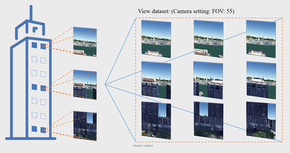
His team have now developed a method to transfer deep learning to assess the nature views (such as green, sky, water) at windows for high-rise high-density areas automatically. “The data source was the photorealistic CIM, surveyed and opened by the Planning Department of the Hong Kong Government in 2019; and the outputs enrich the open CIM with new semantics,” said Dr Xue. “The accuracy was satisfactory on a pilot area in Central, while the processing time per window view was about 1 second on a desktop (Nvidia 2070 GPU) and 0.5 seconds on HKU’s new AI-research platform.”
The work with CIM also focusses on the Nature Accessibility Index (NAI) concerning nature view and nature accessibility, and Dr Xue’s co-supervised PhD student Mr Eric Maosu Li has produced a study titled ‘Save people from the concrete barriers – Integrated assessment of visual and physical accessibility to nature in 3D cities’. The research won the 2021 Esri Young Scholars Award.
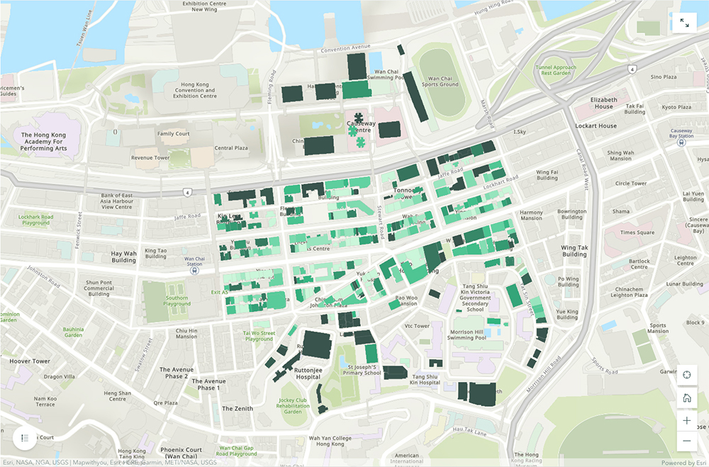
Mr Li’s study focussed on high-rises in an area of Wan Chai and combined visual Nature View Index (NVI) patterns with physical accessibility patterns, with the result being the NAI. “Our findings are useful for providing quantified evidence of the nature visibility and accessibility in a 3D city,” said Mr Li. “The implications can be used to find new means for urban optimisation.”

Automatic window view captured by the City Information Model (CIM), which allows researchers and urban designers to use big data to easily assess view health from any level.

Disparate nature views of 314 buildings in Wan Chai, with the darker colour representing higher quality.
Town planning and policy
The research also highlights inconvenient buildings and promotes urban greenery management and self-greenery management in Hong Kong. The uses for this kind of big data research are numerous for town planning and government policy.
“Quantitative Nature View Indices can help the decision-making of architects, town planners, and designers,” said Mr Li. “Architects used to apply qualitative judgment and domain knowledge to incorporate the views into their multi-criteria decision-making process. In the last decade, they have increasingly used drones to capture the environment and quantify views; however, the drone-based NVI involves high labour costs, and is non-scalable and time-consuming. Our CIM-based NVI has just been proposed for architectural space planning.
“From the perspective of the government, a Visual Impact Assessment report [Town Planning Board 2010] is required for new constructions in Hong Kong. But, it mainly concentrates on the interests of public places (from the outside). For example, will the building obstruct the site views of the harbour/hills/skyline? The NVIs of windows and residents’ exposure to nature have not yet been included.”
This summer, Mr Li worked at Hong Kong’s Urban Renewal Authority (URA) as an intern for two months. “The aim of urban renewal is to realise the sustainability and healthy development of the city,” he said. “Our idea has attracted the URA’s interest, since it can help quantify nature views for large-scale areas automatically – which means at a low cost. However, at the moment they are still focussing on the more scientific utilisation of basic indicators such as building conditions. A city-wide NVI dataset could be helpful in the future.”
This work is the beginning of Hong Kong’s CIM enrichment and Mr Li is now working on new methods that are five to 10 times faster and even more accurate. His future work will also link to AI building optimisation for window views, including aesthetic attributes, nature attributes and cost attributes, and AI town optimisation for both visual and physical access to nature.

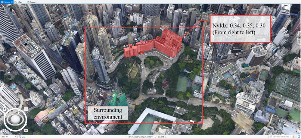
Ruttonjee Hospital (shaded in red) enjoys a higher Nature View Index than its surrounding environment in Wan Chai, thus potentially providing its patients and members with better view health.
The focus of our work is: first, to understand what geometries, semantics and objects are there; second, to quantify meaningful indices (information) for urban analysts; and third, to compute complex concepts (such as streets and environment) as high-dimension vectors.

DR FRANK XUE

